Study Site
Our study site is the Shazhou polder situated in Hexi New Town, located in the south-west of Nanjing City (Figure 1). The polder is surrounded by the Yangtze, Qinhuai, Nanhe and New Qinhuai rivers, and is protected from fluvial flooding by embankments. (Note, here were are concerned with pluvial flooding from intense rainfall.)
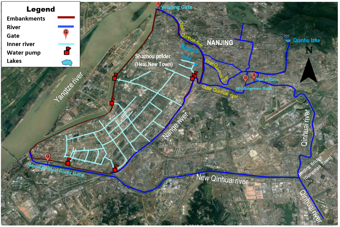
Figure 1. The Shazhou polder, Hexi New Town.
Within the polder there is a network of inner rivers (Figure 2), with two flood gates that control the levels to enhance the city environment. Stormwater that is collected in inner rivers is removed by pumping stations.

Figure 2. Inner river, Shazhou polder
July 2016 Storm Events
Nanjing has an East Asian monsoon climate regime, with high daily rainfall totals recorded in the months June to August. The city experienced a number of intense convective storms in early July 2016 (Table 1). A storm on July 7th caused major pluvial flooding in many districts of Nanjing, with the rainfall total exceeding the historical daily total in many parts of the city. It exceeded the standard level of flood protection of 50 years and was categorized as a red event (>100mm in 3hr).
|
Station |
Code |
Daily Rainfall (mm) |
|||
|
4-Jul |
5-Jul |
6-Jul |
7-Jul |
||
|
Dongshan |
63129400 |
76.5 |
51.5 |
2.5 |
138 |
Table 1. Daily rainfall totals, July 2016
Figure 3 shows the rainfall, inner river water levels and number of pumps in operation for the event. As the inner river water levels rise, the number of pumps in operation is increased. Following the storm, the water is drawn down to a fixed level. If the water levels get too high, storm drains in adjacent urban areas surcharge causing waterlogging.
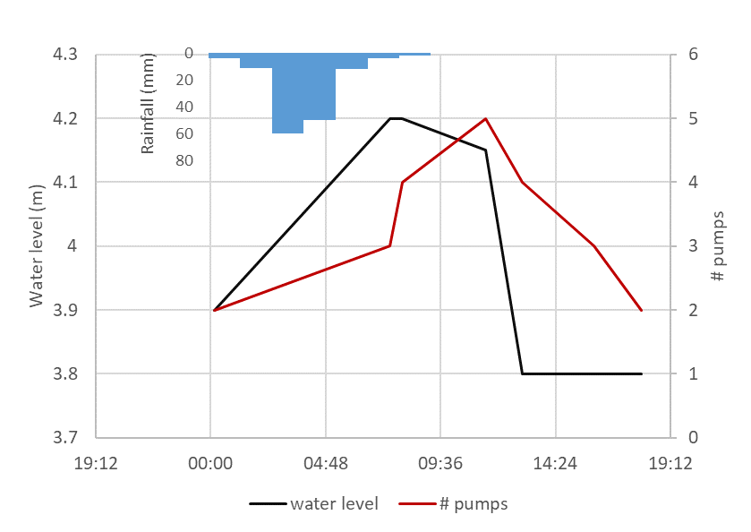
Figure 3. Water levels, pumps in operation and rainfall for the July 7th event.
Motivated by the July storm event, we have contacted decision-makers and cataloged the Risk Response Actions for Nanjing, to improve understanding of the sources of uncertainty in flood forecasting.