Elan Valley
Introduction
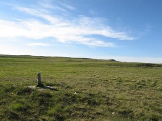
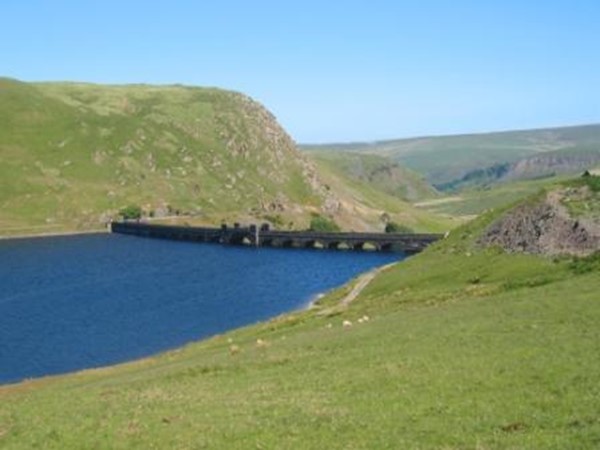
Comprising an area of extensive upland pasture, this case study is located within the Cambrian Mountains Environmentally Sensitive Area and hosts several SSSIs; it also has Special Protection Area and Special Conservation Area designations. Once forming the upland grange for Strata Florida Abbey, and subsequently the summer pastures and sheep walks for local farms, these lands became the setting in the late nineteenth and twentieth centuries for the building of large dams and reservoirs at Caban Coch, Pen-y-Garreg, Craig Goch and Claerwen, to supply water to the city of Birmingham. The flooding of in-bye land and extinguishment of common rights over much – but not all – of the surrounding area transformed both the landscape itself and traditional land use systems.
The case study area comprises two contiguous land units, with contrasting land ownership, management and legal status: the registered common land unit of Cwmdeuddwr Common (RCL 36), which lies on the north and east side of the case study area, is managed by the Cwmdeuddwr Commoners and Graziers Association and remains in private hands; while a large area of de-registered communal grazing (numbered RCL 66 before de-registration) on the south and west of the case study area belongs to the Elan Valley Estate of Dwr Cymru Welsh Water, and is mostly grazed by the Estate’s tenant farms. Study of these contiguous land units allows us to explore issues of definition, boundaries, use and management, across different classes of ‘common’ land.
Background Information
Cwmdeuddwr Common
Common land registration number: RCL 36
Hectares (approximate): 1887.116 ha
Landscape type: upland
Local management: Cwmdeuddwr Commoners and Graziers Association
Statutory designations: Cambrian Mountain ESA, SSSIs, SAC, SPA
Common rights: pasture (sheep, cattle, horses), turbary (peat), estovers (bracken)
Briefing papers
The following paper presents the historical data gathered so far on common land in this case study area. It will be revised and expanded during the course of the project. The paper is accompanied by two maps: the first is a map of manorial boundaries and common land; the second, a map of sheepwalks and related holdings, as suggested by a late 19th-century map found in the Lewis family collection at Powys County Archives (R/D/Lew/2/291).
Elan and Claerwen Valleys Historical Briefing Paper PDF 345Kb
Eleanor Straughton and Angus Winchester, Working Paper (new revised version: May 2009)
Case Study Map 1 PDF 560Kb
Elan and Claerwen Valleys Case Study Map 1: Manorial boundaries and common land
Case Study Map 2 PDF 599Kb
Elan and Claerwen Valleys Case Study Map 2: Sheepwalks, late 19th century (source: Powys County Archives, R/D/Lew/2/291)
Briefing papers
The following papers comprise analyses of qualitative research conducted in the case study area, looking at environmental governance, property rights and land management issues. The research process included stakeholder interviews, focus groups, analyses of common land registers and literature reviews:
Analysis of Common Land Register PDF 211Kb
Rodgers, Chris, Working Paper (October 2009)
Qualitative Research Analysis PDF 358Kb
Elan Valley – Qualitative Research Analysis – Pieraccini, Margherita (revised version – December 2009)
Cwmdeuddwr Focus Group Analysis PDF 109Kb
Cwmdeuddwr Focus Group Analysis – Pieraccini, Margherita, Working Paper (September 2009)
Cwmdeuddwr Focus Group Guided Questions PDF 67Kb
Cwmdeuddwr Focus Group Guided Questions (September 2009)