Inputs
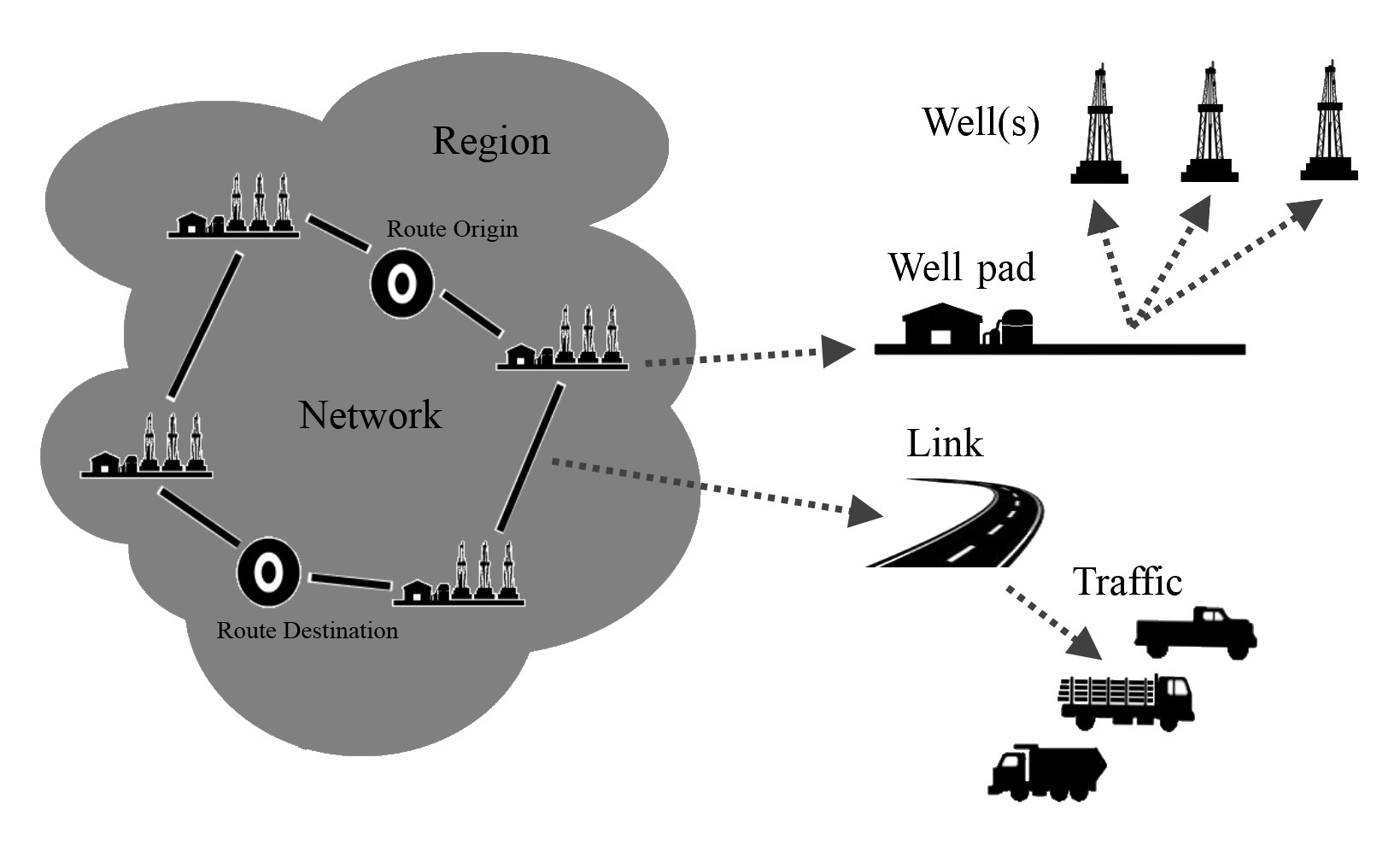
In order to model both the ‘Baseline’ and ‘Sites Active’ scenarios, UHTIMv2 requires a number of inputs. At the heart of the model is the concept of a ‘region’ – a spatiotemporal domain in which activities of interest occur. Inputs to the region include:
- The structure of the underlying road network in the region – both the physical locations and the ‘types’ of roads. The road ‘type’ determines how traffic speeds vary with traffic flow, and may also be used to determine different patterns of emissions;
- The baseline traffic, in terms of a weekly pattern of flow on the region’s roads. If only limited data are available (e.g. only data from weekday peak periods), then appropriate scaling may be used to build a weekly pattern of flow;
- The position of well pad sites, a timetable of well pad activities, and the associated inbound and outbound flows of vehicles associated with each activity, for calculation of ‘site-active’ conditions.
Figure 1 shows an example region, its road network and well pad infrastructure. The road network carries the 'Baseline' traffic flows on defined road links. The well pads contain individual wells, each with their own plan of activities.

Figure 1: A region, with a road network and well pad infrastructure located within it
Figure 2 shows the possible temporal trajectory for development of a well pad. Initial pad development and access road construction, is followed by rig mobilisation, well construction and initial drilling activities. After drilling, hydraulic fracturing may commence at each well. This is then followed by a period of removal of flowback and produced liquids, prior to well completion and operational production. The operational phase may last a number of years, but ultimately, the wells are capped to prevent leaks and contamination, and the pad is decommissioned. Each of these stages may involve different vehicles and timetables of activities within UHTIMv2.

Figure 2: Pad and well activities generate traffic over a period of time
The region concept, the structure of the road network, and the handling of well-pad activities is described in more detail in the Environment International article, as well as the (forthcoming) user manual for UHTIMv2, to be made available on this site. Inputs (and outputs) to (and from) TIM are generally in the form of text files, in comma-separated variable (csv) or structured JSON formats.


