
News & Events
Course on GIS at the McCord Centre for Landscape, Newcastle University
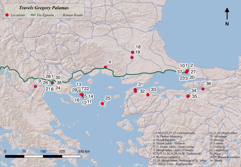
In November 2018, I was offered a week-long introductory course in Geographical Information Systems (GIS) at the McCord Centre for Landscape, Newcastle University. Sessions were led by Dr Francesco Carrer and consisted of an introduction to ArcGIS and QGIS and training tailored to the specific needs of my research project, to help me visualize and chart the coordinates of late-Byzantine sacred landscapes.
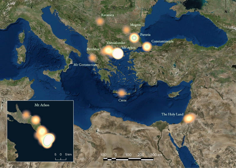
As part of the practical training, I created the maps shown below, which visualize 1) the travels of Gregory Palamas, and 2) the geographical distribution of the areas where holy men practised hesychia, according to late-Byzantine hagiographical accounts. The one that unsurprisingly stands out is Mount Athos, especially its southern tip, but also Paroria, the Holy Land and the urban centres of Constantinople and Thessalonike, as well as their outskirts. As I argue in a forthcoming publication, this spatial diversity has significant implications for the relevance and wider diffusion of hesychasm in late Byzantium and up to the present day.
Last modified: Wed, 05 Feb 2020 16:09:58 GMT