About the Project
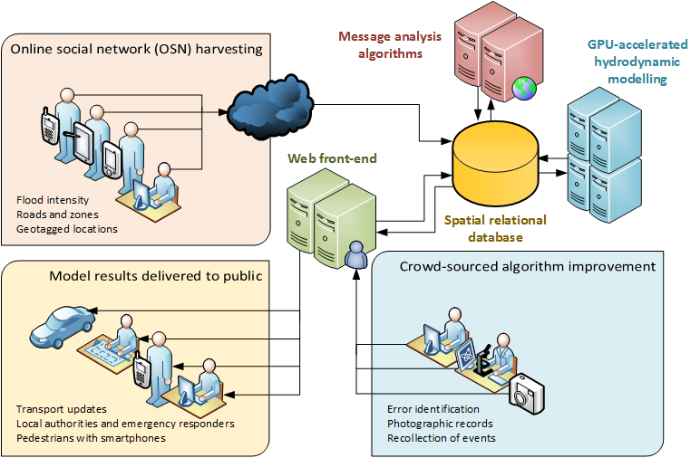
The Integrated Twitter Urban Real-time Flood model will use data provided by the public to simulate urban flooding caused by intense rainfall in real-time. The results are then fed back to the public through social media and an online map showing the most likely affected areas. This site describes how you can get involved, and the technical aspects of how it works.
Anyone with a Twitter account in the Tyne and Wear area can help us, should extreme rainfall hit Newcastle, as happened in June 2012. In return for providing your information:
- our simulation results will be improved, providing you with a more accurate picture of the state of the flooding, so you know which roads to avoid and which routes to take;
- relevant authorities including those responsible for drainage, planning, and highways will have a better picture of how events unfolded, allowing better preparation for any future events.
Messages from social media are analysed automatically, and you can help us by identifying where our system has misunderstood a message, or if it's missed key information that might be useful. We will provide further information about this at a later date.