Topography
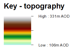
The Haltwhistle Burn Catchment topography (elevation) ranges from 106 metres Above Ordnance Datum (m AOD) in the south in the vicinity of the outlet, to 328m AOD along the northern boundary. Elevation is influenced by the surrounding geology - ridges of crags and columns that form the Great Whin Sill.
Take a look at the interactive map below. Do you want a copy of this map? Go to the 'Download Maps' page.
View larger map


