Ethiopia
The Tana and adjacent Beles catchments have been identified as one of five ‘growth corridors’ in Ethiopia. In view of the priority given to agricultural transformation in this area and availability of hydrogeological data, the Tana basin was selected as a suitable site for the pilot study.
Existing mapping of shallow sedimentary deposits (Figure 1) shows an extensive area to the south of Lake Tana. Several woredas in the basin were considered on the basis of their accessibility, the dominant farming system and their status within the Agricultural Growth Programme. Dangila woreda was selected as the pilot study site.
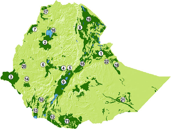
Figure 1: Potential shallow aquifers in Alluvio lacustrine sediments
(Source: Kebede, 2013)
Dangila woreda is situated in the north-western highlands with altitudes generally between 1850m to 2350m. Dangila town is situated along the Addis Ababa-Bahir Dar road at a distance of 80 km south west of Bahir Dar (Figure 2). Part of Dangila woreda drains north-east towards Gilgel Abbay River and Lake Tana; the remaining area drains either west or south-west towards Beles River. The climate is sub-tropical (local classification “Woina Dega”). Annual rainfall is around 1600mm with the main rainy season occurring June-September.
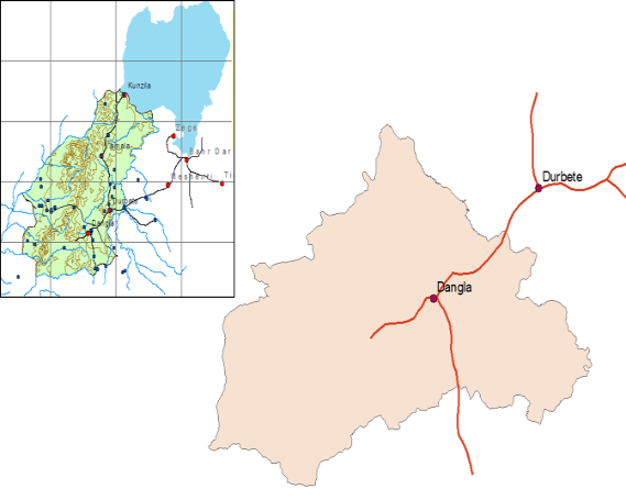
Figure 2: Location of Dangila
The total population of Dangila woreda is estimated at about 279,500 people. Crop–livestock mixed subsistence farming is the primary source of livelihood. According to a recent survey (Belay and Bewket, 2013) approximately 14% of cropland is irrigated, which equates to about 0.20 ha of irrigated land per household. Despite this small size, irrigated land is seen as important both in terms of cash income and household nutritional benefits.
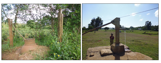
Irrigation is mainly by means of shared gravity diversions from seasonal and perennial streams, though there are some reports of water lifting. There are many shallow (10-12m) dug wells throughout the woreda (Figure 3a), but they are used for domestic supply. Preliminary assessment indicates that there is no current use of groundwater for irrigation. There are some deeper drills wells fitted with hand-pumps (Figure 3b) and some springs have been developed for community water supply.
Figure 3: (a) Typical household dug well and (b) community well.
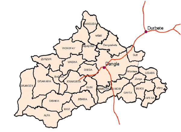
The woreda comprises 27 rural kebeles (Figure 4). Three were selected for detailed study on the basis of (i) road access as proxy for market orientation which is necessary for adoption of groundwater irrigation, (ii) experience in small scale irrigation, (iii) potential of shallow groundwater and experience of small-scale irrigation. The selected kebeles are: Kwakurta, Gult and Dengesheta.
