WP2: Coastal Systems
Modelling beach change and overtopping of natural and engineered beaches
Contact: Harshinie Karunarathna h.u.karunarathna@swansea.ac.uk
Coastal systems which interact with complex multiple environmental variables exhibit memory. For example, antecedent near-shore morphology of a beach system significantly modulate the response of the beach to an extreme event and hence, wave overtopping and flooding. Largest changes to beaches take place during extreme storm conditions. However, non-storm wave conditions that prevail between extreme events continually alter beach morphology to bring them back to a recovery state. The level of recovery depends on the interval between two extreme events, which may be a few days to few months.
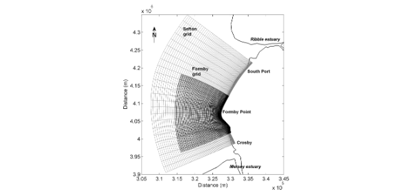
In modelling the impacts of storm clustering process on coastal flood systems, widely used and well calibrated coastal area model XBeach will be applied to Sefton Coast. Sefton has been chosen because it is a complex beach system comprising natural beaches, rapidly eroding dunes, flood-prone urban and rural hinterland and hard & soft defence systems with areas of overlap. Vast datasets are available from both model hindcast and monitoring of hydrodynamics, beach profile & shoreline surveys. Morphodynamic response of both natural and engineered sections of the Sefton coast to clustered storm events and resultant wave overtopping volumes will be modelled in order to determine flood inundation.

Sefton coast model domains; XBeach finer grid setup (Formby grid) and Delft3D/SWAN coarser grid setup (Sefton grid)

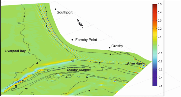
Sea bed erosion (blue) and Sedimentation (red) of Sefton coast during the March 2010 storm event (from 27 March to 04 April). Contours indicate the initial bed topography
Swash Zone Subsurface Flow Model
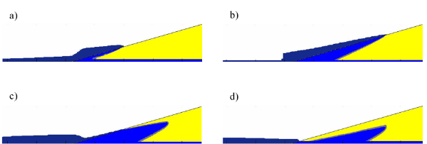
During storm events the swash zone dynamics play a significant role in beach erosion and flooding. A novel subsurface model is being used to simulate the infiltration/exfiltration from the wave uprush, along with air and groundwater movement within the beach. The model uses the volume of fluid method combined with a 2-d finite volume tracking algorithm to identify the air-water interfaces. Once tested and validated the model will be used to investigate the effect of the subsurface flow processes on beach erosion and flooding induced by repeat storm events.

Surface and subsurface water profiles during a single swash event: (a,b) illustrates the infiltration of surface water during wave run up, (c,d) illustrates the movement of water during wave backwash.