Coalburn2020
Coalburn2020 is an exciting research experiment considering the effect of forests on river flows. The plan is predict the effect that the recent tree felling in the Coalburn catchment has had on annual river discharge and peak flows. Significantly, this is without having seeing the post felling streamflow data. More details are in the Research Plan.
Catchment Description:
- Coalburn is the UK's longest running forest research catchment.
- Coalburn is a 1.5 sq. km catchment.
- The catchment was instrumented in 1967
- In 1972/73 the catchment was ploughed and planted with a conifer forest.
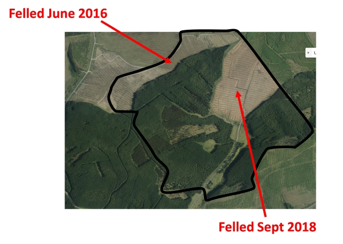
- The trees are now mature and around 30% of the catchment is currently being felled.
The catchment is located in the very north of England, close to the Scottish border. It is part of the Kielder forest. Coalburn is a sub-catchment of the Irthing which flows into the Eden near Carlisle.
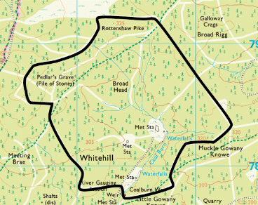
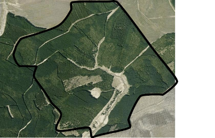
A OS map of the catcment (Crown Copyright/database right 2014. An Ordnance Survey/EDINA supplied service) and an aerial photograph (copyright Google, Infoterra Ltd and Bluesky) can be seen below.


The recent felling of the Coalburn catchment is shown below
