Future Meetings
Prehistoric communities and their landscapes
This meeting aims to address the relationship between prehistoric communities and their landscapes. Landscape archaeology has moved away from simply being a study of settlement, or of land use, to embracing new ways of interpreting the evidence. How can these be explored alongside more traditional approaches? How can we combine social and cultural questions about prehistoric communities with research into prehistoric landscapes, environment, climate, ecology? To what extent can we relate communities to landscapes, and what kinds of landscapes rub up against one another in the region? To what extent should studies focus on specific kinds of landscapes (coastal, lowland, upland, etc)? As well as hearing the results of previous and ongoing research, the meeting is aimed at fostering future research projects. What opportunities for research into prehistoric communities and their landscapes are currently under-appreciated? What activities might promote further research? Which landscapes are well-understood and which are in dire need of further attention? We welcome discussions of the results of recent and ongoing research, re-examinations of 'classic' contributions, and consideration of what is needed in the future.
Alan Saville and Richard Tipping- National Museums of Scotland and Stirling University
Scotland’s first Late Upper Palaeolithic settlement at Howburn and its landscape
The first Late Upper Palaeolithic open-air site to be found in Scotland, at Howburn, near Biggar in South Lanarkshire, is described and an account given of the composition and distribution of the lithic assemblage. These are set in its British and north-west European context. Provisional parallels drawn are with the Late Hamburgian (Havelte) sites and assemblages of southern Scandinavia, northern Germany and the Netherlands. There is no absolute dating evidence for the site, but an age in the region of 12000 14C yr BP, towards the end of the earlier (Bølling)
Lateglacial Interstadial stage, is proposed on the basis of the lithic artefacts. Analyses to date of former lake sediments adjacent to the site are assessed and the potential for future work is explored.
Clive Waddington - Archaeological Research Services Ltd.
Mesolithic settlement and the arrival of narrow-blade microliths into Britain: excavations at Howick, Northumberland.
The recent discovery of a Mesolithic hut site at Howick on the Northumberland coastline of Britain has revealed evidence for a sturdy dwelling that provided long-term occupation spanning several generations. The excavation has provided important evidence for the spatial arrangement of activities in the hut as well as the type of activities and food resources consumed at the site. A high resolution radiocarbon dating programme has provided some unique insights into the duration of occupation over the various phases of the hut’s life. It is apparent that the other similar hut sites in the British Isles (e.g. East Barns, Broom Hill, Mount Sandel) are contemporary, dating to the beginning of the 8th millennium cal BC, suggesting that these types of dwelling structure are a temporally distinct phenomenon, at least in the British Isles. In searching to explain this pattern attention is drawn to the earlier arrival of narrow blade microliths evidenced at Howick and other North-East British sites and this phenomenon being coeval with rapid sea-level rise that took place at this time. Displacement of populations inhabiting the North Sea Plain to surrounding higher ground may have driven the need for more visually imposing and 'permanent' structures as groups strove to maintain territorial control and access to resources.
Bob McCulloch - Stirling University
Landscape change before, during and after the construction of Dere Street, Dun Law Hill, Scottish Borders.
Two peat profiles from Dun Law Hill, at the western end of the Lammermuir hills, Scottish Borders, provide detailed records of mid-Holocene to present landscape change reconstructed from fossil pollen and gross stratigraphical peat and sedimentary changes. The two profiles were sampled during the archaeological excavations on Dun Law Hill in 2007 for the extension of the Dun Law wind farm and provide evidence for landscape change before, during and after the construction of Dere Street. The cobbles forming the surface of Dere Street were removed and an underlying brushwood layer exposed. Beneath this road material a peat / organic rich sediment within a palaeochannel was identified and a 111 cm profile (Dun Law 113) was sampled. A further lattice structure of wooden spars appears to represent a foundation layer across the palaeochannel. A second 185 cm profile (Dun Law 3) was sampled from a small basin close to the road and this provides a complementary continuous record of landscape change for during, and after the construction of Dere Street.
The two peat and sediment sequences from Dun Law 3 and Dun Law 113 span the period c. 4,500 BC (c. 5,700 14C yrs BP) to present in an area where there is limited evidence at present. The landscape reconstruction indicates a natural succession of the upland woodland cover at Dun Law during the mid-Holocene followed by small-scale incursions into the upland woodland during the Neolithic period. Large-scale woodland clearance occurs from c. 850 BC (c. 2,700 14C yrs BP) and appears to have been sustained up to the construction of Dere Street, including the final removal of hazel shrub cover, probably for the construction of the road itself. Post Roman-Iron Age, the cleared landscape appears to have been maintained probably for the use of resources of willow and pasture.
Gavin Macgregor - GUARD, Glasgow University
Past Landscapes, Present Perceptions, Future Research
In this presentation, I will briefly consider the ways in which past landscapes have been categorised and understood in archaeological interpretations of the Tyne-Forth region. I will then explore a variety of contemporary ways in which landscapes are categorised and understood. Finally, I will outline different approaches to landscape research and assess their potential implications for future research in the Tyne-Forth region.
Derek Hamilton - Scottish Universities Environmental Research Centre/University of Leicester
Later prehistoric settlement from the Tees to the Forth: the timing of transformation and the tempo of renewal
The use of radiocarbon and Bayesian modeling to create robust chronological frameworks for 18 sites from the Tees to the Forth has begun to show that settlements in this area were capable of swift change. My recent PhD research suggests a far more dynamic model of Iron Age society than perhaps previously allowed, with settlements across the region suddenly shifting from open and nucleated to dispersed and enclosed at approximately the same time (c. 200 BC) and then equally abruptly back to more open and dispersed settlement around 50 BC. This research has also begun to shed light on the tempo of renewal within the settlement – both of roundhouses and ditches. Furthermore, the latter part of this period sees ‘native’ people coming into direct contact with the Roman invading force and the new chronologies coupled with the material culture from these sites is beginning to shed light on the varying ways that invasion was negotiated.
Roger Miket
The Iron Age: The End?
‘Whither the division between prehistory and history is relevant to our region’.
While the name of our group is unequivocal as to the geographical extent of its interests – the region from around the Forth down to the region around the Tyne – what ‘Prehistory’ encompasses remains undefined –other than that it must cease when history begins. Within the broad idea that such definitions should somehow involve the written record, it is clearly in our interests to agree such a definition of ‘History’ as will best serve a forum which, from the outset has placed a better understanding of the indigenous population at its heart.
While we might debate the degree, it seems fairly plain that our indigenous population enters history only when it becomes sufficiently visible through the written word for something worthwhile to be understood of its nature and development. A handful of place names, or a notice of when it came into conflict with foreign interests do not constitute a history of a native community. Such casual notices might point up an individual or lightly denote a grouping, but they hardly provide a dynamic that either illustrates their nature or their activities in such a way as we might recognise and define as a historical narrative. The general lack of Roman written records of an appropriate type leaves us - as for earlier centuries - entirely dependent upon the information that can be derived from the application of archaeological techniques. For us then, ‘Prehistory’ must surely be said to continue until around the later 6th/early 7th centuries AD, when the written record begins to provide such a narrative across the whole of our area. Whether the end of ’Prehistory’ coincides with widespread and extensive cultural change is to debate quite another question.
Tyne-Forth News and Views
Kristian Pedersen - School of History, Classics & Archaeology, Edinburgh University
Mesolithic-Neolithic archaeology and landscapes at Bradford Kaims, Northumberland
The wetlands at Bradford Kaims were a series of lakes through the prehistoric era and into the Medieval period. The first of several seasons work has focused on generating predictive models to identify areas of potential settlement. A series of trenches were excavated at the point where the largest lake discharges into a river, which flows into further lakes and ultimately into the North Sea. It was possible to establish the highest level of the lake in the stratigraphic sequence, and a flag-stone structure sealed beneath thick colluvium and a layer of lacustrine detrital mud. This has afforded some lithic material and animal bone, provisionally dated by archaeomagnetic methods to between 4500 BC and 4000 BC. If this is correct, the site would be one of the few from the terminal Mesolithic or incipient Neolithic in Britain. More research shall unfold this summer.
Lindsey Buster - University of Bradford
Living traditions: Iron Age dwelling practices at Broxmouth and beyond.
Continuous development from timber to stone-built architecture at Broxmouth supported emerging ideas that the latter developed from long-lived, native, traditions and was not the product of incoming Roman culture. This native tradition was named ‘Votadinian’, after the local tribe thought to have inhabited the Tyne-Forth region during the Iron Age. Whilst tribal or cultural labels are now less popular, one of the impacts of the Broxmouth excavations was, not only to push back the date for the stone-built architecture in this region, but to emphasise that an architectural ‘tradition’ rests far more upon the use of space within a building than the fabric from which it is made. In order to reflect this, I am exploring ‘traditions of inhabitation’ at Broxmouth and in other regions, to ascertain whether or not such traditions exist, whether they are regionally bounded, and if indeed, ‘traditions of inhabitation’ are an appropriate way in which to study domestic architecture in the past. Chiefly, my main research question is to assess the ways in which Iron Age roundhouses structured and facilitated the daily lives of their inhabitants.
Continuous development from timber to stone-built architecture at Broxmouth supported emerging ideas that the latter developed from long-lived, native, traditions and was not the product of incoming Roman culture. This native tradition was named ‘Votadinian’, after the local tribe thought to have inhabited the Tyne-Forth region during the Iron Age. Whilst tribal or cultural labels are now less popular, one of the impacts of the Broxmouth excavations was, not only to push back the date for the stone-built architecture in this region, but to emphasise that an architectural ‘tradition’ rests far more upon the use of space within a building than the fabric from which it is made. In order to reflect this, I am exploring ‘traditions of inhabitation’ at Broxmouth and in other regions, to ascertain whether or not such traditions exist, whether they are regionally bounded, and if indeed, ‘traditions of inhabitation’ are an appropriate way in which to study domestic architecture in the past. Chiefly, my main research question is to assess the ways in which Iron Age roundhouses structured and facilitated the daily lives of their inhabitants.
Chris Bowles - Borders Region Archaeologist
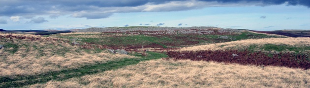
The Prehistoric in Microcosm: Recent Finds on Soutra Hill, Scottish Borders
A recent evaluation by GUARD ahead of quarry expansion on Soutra Hill, south east of Edinburgh, has uncovered the remains of a multi-period prehistoric landscape: a cairn, timber circle and cord rig all point to the extensive use of the hill. Post-excavation work is still in progress but the work may shed much light on the complexities of land-use in later prehistory.
David Cowles, Richard Tipping, Ian Armit and Derek Hamilton
From landscape archaeology to landscape change: East Lothian in Later Prehistory
Traprain Law and its environs is probably the best understood later prehistoric landscape in NW Europe. The exceptional, though selective cropmark record of later prehistoric settlement on the lower ground around the Law provides the best example to link data on landscape change to landscape archaeology. The aims of this AHRC proposal are to (a) establish a more complete inventory of settlements through sophisticated aerial photographic techniques, (b) demonstrate from this survey ‘blank’ areas of the landscape, (c) further test the chronology of settlement through key-hole excavation and 14C dating, (d) generate through time the spatial pattern of settlement types across the landscape, (e) construct highly resolved pollen analyses from several small-medium diameter peat basins to understand later prehistoric land use history at the farm-scale, and in particular, map the development of the massive later Iron Age woodland clearance, (f) collect data on soil erosion and land degradation from colluvial sequences, before synthesising these data-sets in a nearly complete reconstruction of this key agrarian landscape.